
When the Cold War came to Algonquin Park
When the Cold War came to Algonquin Park
And what took its place?


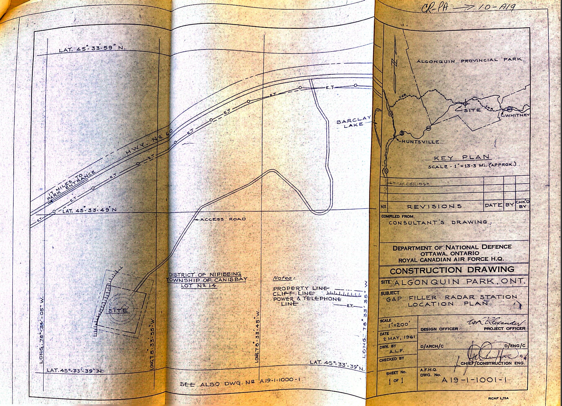
You should start off at the Algonquin Park Post Office. The old one, the one by Cache Lake that was closed in 1980.
Head northeast along Highway 60 for 1.7 miles. At this distance, you’ll see that the Bell telephone and hydro pole has a mile marker on it. It’s #17. Start counting the poles after that one. Count six more telephone posts, and then about half the distance to the seventh you will see a lone spruce tree.
The spruce is your signal to turn south and keep going until you reach a sheer rock cliff rising twenty feet in the air ahead of you. Turn west, and head up the incline for, say 2,000 feet, until you have reached the high ground.
On top of the plateau, the highest section is the northwest corner. But before you notice the height of the ground, you will have seen it. You will have been heading towards, then away, and then back again toward a handful of buildings — relics of the Cold War.
In 1959, the directions above were provided to initiate a field survey. The survey was to place the markers for the buildings and tower of a Gap Filler Radar Station in Algonquin Park.
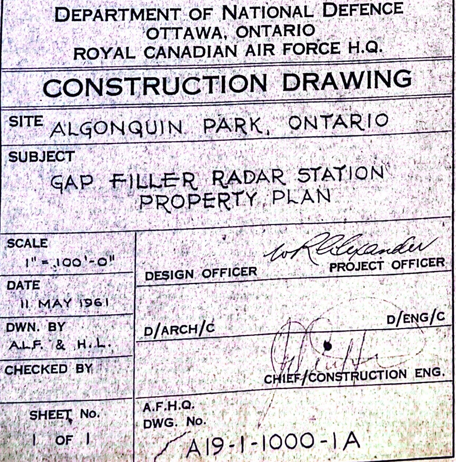
Canada and the United States had established a series of radar lines to provide warning of Soviet bomber attack on North America. The Gap Filler Radars were smaller stations designed to provide supplemental coverage for low-altitude areas where the Pinetree Line had “gaps.” Algonquin Park was one of the two-dozen such sites in Canada. (Steffan Watkins has an excellent blog post on the subject, and he did the hard work of locating and posting the longitudinal and latitudinal data for each site.)
In 1962, the plateau in Algonquin Park was logged. It was mostly maple, with some hemlock and a little bit of elm, birch, beech and a cherry tree. The federal government had to pay the provincial government for the timber felled, including the extra costs — a “bonus” — for cutting down yellow birch.
The cleared land was then sprayed down with a “brush control” spray.
Foundations were laid for a radar building, a second building for the power connections and accommodations, and a third for the tower itself. A road — the one visible in the images — was cleared, too. Electric power was run to the site. The tower went up.
The Road to Nowhere
By the day the bill came in for the timber, in July 1962, there was already doubt brewing about the Gap Filler Radar’s future. As the Deputy Minister of Transport put it to the Deputy Minister of National Defence:
“…it may be that due to the present austerity program you will not be proceeding with this installation.”
He was right. A month later, in August 1962, a new memorandum came down from on high: “Termination of Construction — Gap Filler Radar Stations”

The memorandum called for completion of the station buildings, and then for the site to be put off limits.
“The access road shall be closed with a 14 ft. farm type gate, wood posts, braced on hanging side, 48 inch 9 gauge farm type fencing.”
Everything was to be locked up. Doors and windows were to be sealed from both outside and inside using waterproof plywood “or equivalent.” Pipes capped. Storage tanks drained.
Both the site, and the wiring and other accoutrements intended for the facility were declared surplus.
On September 23, 1964, the “Tower at Algonquin Park,” along with the other outbuildings and fence were sold to the Province of Ontario, and put in the care of the District Forester of the Departments of Lands and Forests (in Pembroke, Ontario). The Department of National Defence arranged to send over the keys to the locked-up buildings.
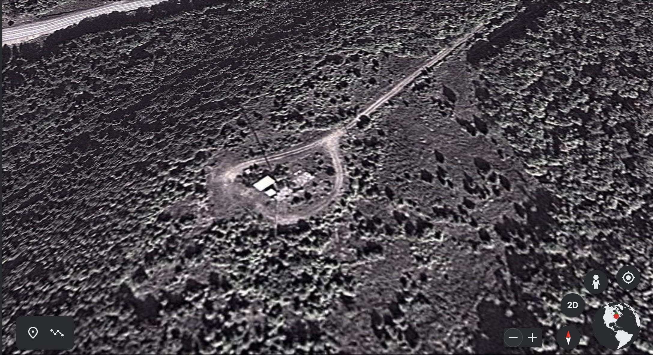
Compare the 1961 construction drawing with an image from today’s Apple Maps:

A Strange Turn
I first used Apple Maps to have a look at the present-day site, but then tried Google Earth. From Google Earth, a tower and its shadow are visible. The tower does not look, to me, like the type of tower that would accompany a Gap Filler Radar. Perhaps the site has been repurposed.
I decided to “drive by” the site using Google Maps. Sure enough, there was the gated access road.
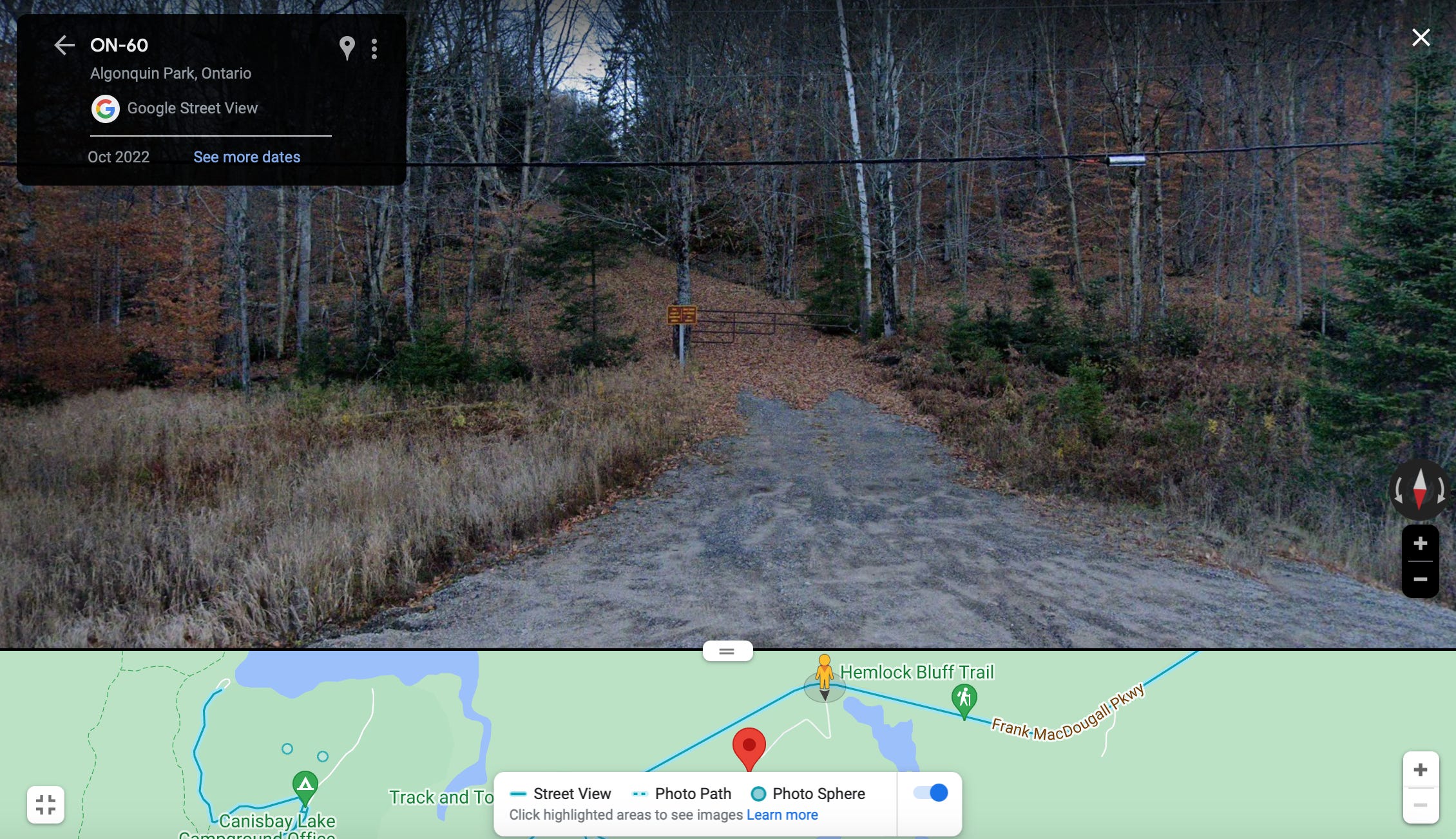
A Google Maps car has not driven through the gate, and so I could only proceed along Highway 60. When I got to a point where I thought I might be able to see the tower from the highway, the view was blurred. I tried many different angles to confirm that there was nothing else on the roadside, or in the trees, that might reasonably be blurred. I think the blurring hides the tower.
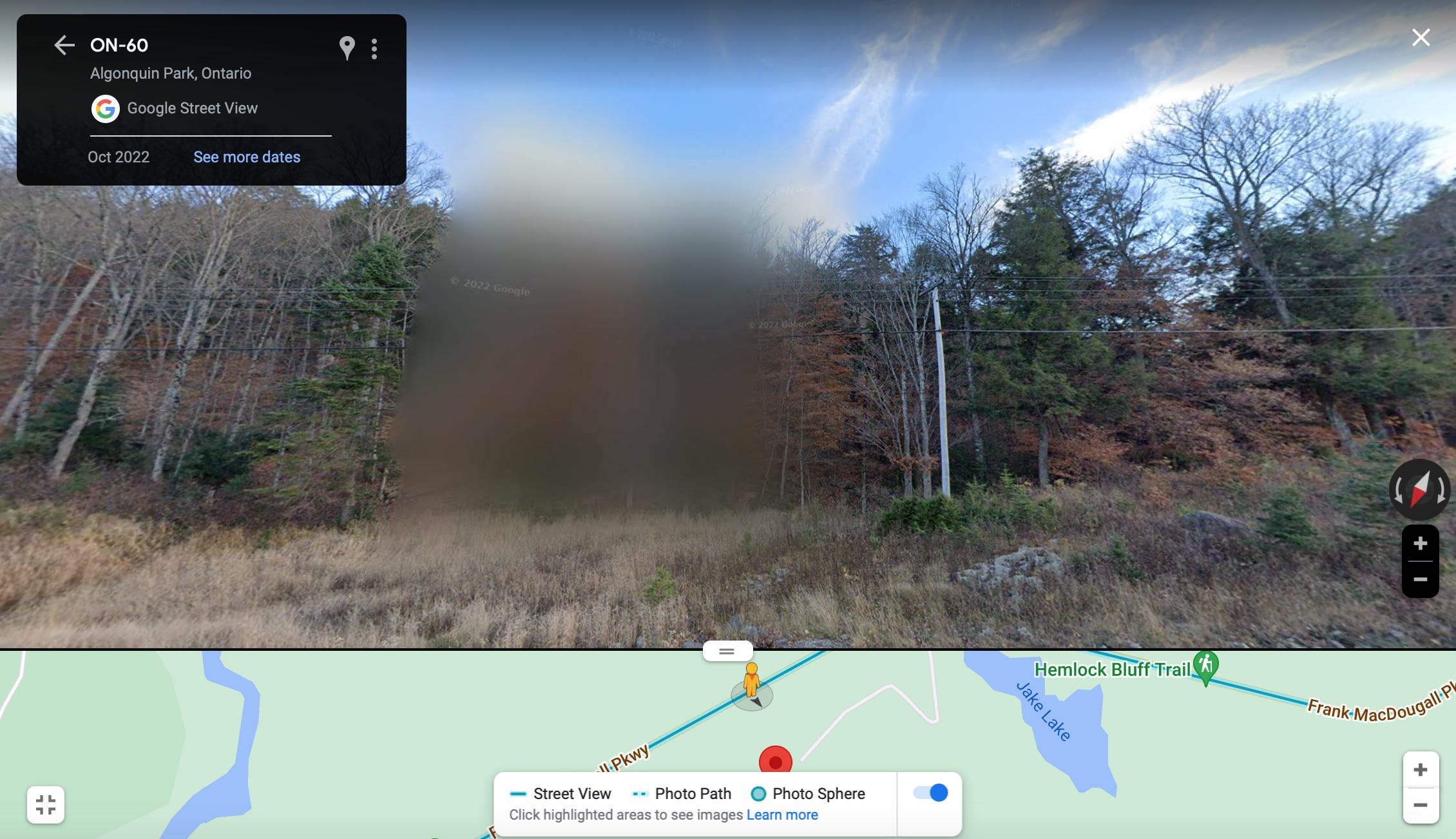
I decided to “drive” even further down the road and look back.
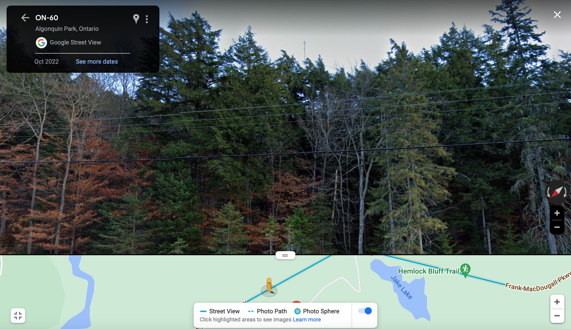
And there was the tower that could be seen from the Google Earth satellites — and, I presume, by any of the thousands and thousands of campers and others driving down the highway!
The Google Maps car always gets through.
Bonus: The Best Letterhead in Government Award…
…goes to Ontario’s Department of Lands and Forests!

***
Records of the GPRF project at Algonquin are in RG24-E-1-C Vol. 21875 File 10-A-19 “Buildings, Aerodromes, Grounds and Utilities - Algonquin Park, Ontario,” Library and Archives Canada. Special thanks to Sam Eberlee. And thanks, too, to Steffan Watkins for the previous digging he did on this subject. Again, his post is here.
Hmmm. I wonder how much the federal gov't paid the provincial gov't for the timber and how much the province paid the federal gov't for the boarded up radar station :) I think a little road trip is in order here. lol